The author helps readers understand the method scientists use to determine a spacecraft's distance from Earth by using an analogy that relates the idea to readers' lives. The correct answer is C.
In paragraph 4, the author explains that to determine a spacecraft's distance from Earth, navigators send a signal to the spacecraft, which then returns it to Earth. The time it takes for the signal to make that two-way journey reveals the spacecraft's distance from Earth because the signal travels at a known speed (the speed of light).
To make this concept more relatable, the author provides an analogy in paragraph 4. They compare it to a situation that most people experience in their daily lives. For example, if you know you can walk about a mile in 20 minutes, you can calculate the distance to a grocery store that is a 30-minute walk from your house. This analogy helps readers understand the concept of using the time it takes for a signal to travel to determine distance.
By using an analogy that relates the idea to readers' lives, the author creates a familiar context that makes the method easier to understand, especially for schoolchildren.
The information in paragraph 12 connects the information provided in paragraphs 13 and 14 by explaining how the use of mercury ions in the Deep Space Atomic Clock makes autonomous navigation possible. Mercury ions are atoms with a net electric charge. In atomic clocks, the atoms are typically contained in a vacuum chamber, and in some cases, the atoms interact with the vacuum chamber walls. However, this interaction can lead to frequency errors caused by environmental changes such as temperature.
To prevent these errors, the Deep Space Atomic Clock uses mercury ions, which have an electric charge. These ions can be contained in an electromagnetic "trap," which prevents them from interacting with the vacuum chamber walls. As a result, the Deep Space Atomic Clock achieves a new level of precision, up to 50 times more stable than atomic clocks on GPS satellites. This level of stability makes autonomous navigation possible for missions to distant destinations like Mars or other planets, with minimal communication to and from Earth.
Therefore, the correct answer is D. The information about the use of mercury ions in the Deep Space Atomic Clock connects the explanation of precision and stability in paragraph 13 with the statement that such precision enables autonomous navigation in paragraph 14.
The correct answer is C. to guide readers' understanding of a complex topic.
The author uses a question-and-answer format to develop the main points of the passage in order to guide readers' understanding of a complex topic. By presenting questions and providing answers, the author breaks down the information into digestible chunks and makes it easier for readers to follow along and comprehend the subject matter.
Using this format allows the author to address specific questions that the readers might have while also providing detailed explanations and justifications for the answers. It helps to clarify the concepts and ensure a thorough understanding of the topic.
Additionally, the question-and-answer format allows the author to cover various aspects and subtopics related to the main subject in an organized and structured manner. It helps to present information in a logical sequence, making it easier for readers to follow the progression of ideas.
Therefore, the primary purpose of using a question-and-answer format in this passage is to guide readers' understanding of the complex topic of atomic clocks and their significance in space navigation.
Answer and explanation: This is a Robinson map of the world. The Robinson projection was created in 1963 by the geographer Arthur Robinson. The projection seeks to balance different types of distortion. The projection isn't perfect, but it is considered more visually appealing than others. It balances small distortions of area, shape, distance, and direction.
Answer:
Their goal was not only to separate South Africa's white minority from its non-white majority, but also to separate non-whites from each other, and to divide black South Africans along tribal lines in order to decrease their political power.
Strategists in the National Party invented apartheid as a means to cement their control over the economic and social system. Initially, aim of the apartheid was to maintain white domination while extending racial separation. ... With the enactment of apartheid laws in 1948, racial discrimination was institutionalized.
Thus question lacks a picture or option, but nevertheless:
Answer:
There are 3 types of friction:1) Static friction - when you apply force and the object does not move.2) Sliding friction - when the surface if the object moves on other.3) Rolling friction - when any wheel or ball moves on any surface rolling friction is applied. it is very less than sliding friction.
When it comes to areas that humanity does not affect in terms of vegetation, colder areas such the Tundra come to mind.
The Tundra is known for:
- Very cold climates
- Low number of animals and plants
- Limited sunlight
As a result of the cold weather and the limited number of plants and animals in the tundra, humans generally avoid this environment which ensures that there is little effect of humans on natural vegetation patterns.
In conclusion, tundra areas do not see a lot of human influence on vegetation.
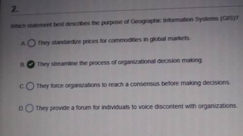
A. They standardize prices for commodities in global markets
B. They streamline the process of organizational decision making.
C. They force organizations to reach a consensus before making decisions
D. They provide a forum for individuals to voice discontent with organizations.
Answer:
B. They streamline the process of organizational decision making.
Explanation:
A geographic information system (GIS) is a type of database containing geographic data (that is, descriptions of phenomena for which location is relevant), combined with software tools for managing, analyzing, and visualizing those data. In a broader sense, one may consider such a system to also include human users and support staff, procedures and workflows, body of knowledge of relevant concepts and methods, and institutional organizations.
The article states that the Incas developed knowledge of farming in the Andes region over the course of 11,000 years. This information shows that they refined their farming practices over time. The use of gravel, terraces, and canals allowed the Incas to adapt farming to the difficult terrain.
When birds are hungry, they will peck unripened fruit. Also, if there is no other fruit around, the birds might go after unripened fruit. Heavy bird pecking can be used as an indicator that it's ready to start harvesting.
Birds need food to eat, and plants need to disperse their seeds. Fruit-eating animals are called frugivores, and birds are the most important frugivores of all. More than 300 trees, shrubs, and vines in North America have small fruits that depend on birds for seed dispersal.
 1
1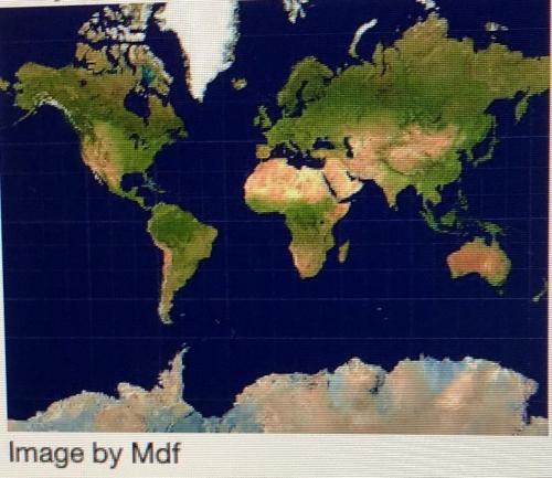
 [youtube=iCHaJR831t4]

