Geography : asked on mjmckay03
 10.09.2021

article of world geography and summarize it

. 5

Faq

Social Studies
Step-by-step answer
P Answered by PhD

1. A. Africa

Currently, there are many regions africa that still involved in a civil wars that initiated by independent groups in order to take control of the government. Their economy is in a stagnation and the environment around them is not in a good condition. It is predicted that 10,000 deaths occurs because of political instability in Africa every year.

2. C) The water supply decreases because there are too many people

Water is regarded as the most important basic needs for humans. When a population increase in a certain area, the demand for water would also improve. This would cause a larger depletion in water shortage, leading the the decrease of water supply.

3. Incomplete, map needed.

4. Incomplete, map needed

5.The answer is: B. The Sahel

The sahel crossed more than 10 countries in Africa continents. Currently, the water reserve in the sahel is drying up in an alarming rate. This cause the process of desertification that makes many people in africa died from hunger.

6. incomplete, map needed

7. C. The desert Basin

The desert basin is extremely dry during the summers,  which often lead to the lack of water reserve for the population. Because of this, the population would most likely spread out because they know that they would not obtain enough water to sustain themselves if they are concentrated in one location.

8. B.There are many different language and cultures in Africa

Currently, it is predicted that there are around 375 language spoken in Africa. The amount of cultures in africa is depended on the unique characteristics of the local tribe. Africa have approximately around 450 different cultures with their own unique characteristics.

9. D. Physical geography

Physical geography include tangible features that exist in a certain area. Physical geography of a certain area is formed naturally without the influence of humans and it was considered as a part of major sub-field in Geography.

10. B. Religion

Even though this is not the sole reason, religion become a large part of the conflict. There are a couple of difference exist in each of their holy bible and Both sides often used it to justify the act of violence that they throw to each other.

11. D. Saudi Arabia

A nation would be considered as a monarchy if its headed by Kings or Queens and the throne is passed down through bloodline. In this type of country, people cannot elect a leader by their own and usually the most power in the country is held by those from nobility background.

12. A. increasing fuel price

The territory that controlled by Al Qaeda contains the oil reserve that supply a large portion of world's oil demand. This cause an increae in fuel price especially for the countries that involved in the conflict due to the difference in ideology.

13. incomplete, picture needed

14.   B. Niger River

TThis river is the third longest river in africa and responsible to maintain the well being of many type of biodiversities in Africa. This is so vital for Africa because it become the water source for large numbers of agricultural field in Africa (which is one of their strongest economic sectors)

15. B. Dictatorship

In a dictatorship, there is a single leader that can determine the creation of any type of laws that He want and the citizens do not have any power to change this leaders without revolution. It is a common practice for dictators to kills the citizens that are not willing to comply with their law.

16. A) Kurds are likely found in neighboring countries.

Due to the political instability that happen in their home countries, many of the Kurds decided to find asylum in other countries. Their neighboring countries would most likely receive the largest amount, but millions of the Kurds found their asylum in western nations (such as canada or germany)

History
Step-by-step answer
P Answered by Master
Spring (March, April, May) and autumn (September and October) are generally cooler, more comfortable times to visit.

The United States has varied weather conditions, and the best time to visit depends both upon the location and the season.

Many of the country's dependent territories, such as Guam, Puerto Rico, and the US Virgin Islands, are also tropical.

The country's dependent territories are offshore and have distinct geographies of their own; the majority are islands.

In some parts of the country, travel services may be limited during the low or off-season, largely due to weather conditions.

Geography Covering a large part of the North American continent, the USA shares borders with Canada to the north and Mexico to the south.

The southern part of the country tends to be warmer than the north.

Outdoor-lovers will need clothing and shoes that are appropriate for the terrain and the activities they have planned; visitors to cities will need a range of casual outfits and perhaps one smarter outfit for a fine dining or theatre outing.

Though there are many cities that are densely populated with more manmade features than natural ones, there are also vast rural areas that are far more sparsely populated.

The general climate of the continental US is temperate, but keep in mind that Hawaii is tropical and Alaska is arctic.

Required clothing: As the US is a vast country with varying climates and four distinct seasons, packing clothing that allows you to layer for warmer and cooler conditions is recommended, especially if you plan to travel to different regions of the country.

Summer is considered the peak tourist season throughout the country; other popular travel times are major American holidays, especially Thanksgiving and Christmas, as well as Easter Week and the school holiday known as Spring Break.

The climate ranges from subtropical to arctic, with a corresponding breadth of flora and fauna.

For a more detailed description of each region's geographical characteristics, see the individual state sections

The summer months (June, July, and August) are generally hot regardless of the region, but winter temperatures (November-February) can vary substantially depending upon the part of the US you are visiting.
History
Step-by-step answer
P Answered by Specialist
Spring (March, April, May) and autumn (September and October) are generally cooler, more comfortable times to visit.

The United States has varied weather conditions, and the best time to visit depends both upon the location and the season.

Many of the country's dependent territories, such as Guam, Puerto Rico, and the US Virgin Islands, are also tropical.

The country's dependent territories are offshore and have distinct geographies of their own; the majority are islands.

In some parts of the country, travel services may be limited during the low or off-season, largely due to weather conditions.

Geography Covering a large part of the North American continent, the USA shares borders with Canada to the north and Mexico to the south.

The southern part of the country tends to be warmer than the north.

Outdoor-lovers will need clothing and shoes that are appropriate for the terrain and the activities they have planned; visitors to cities will need a range of casual outfits and perhaps one smarter outfit for a fine dining or theatre outing.

Though there are many cities that are densely populated with more manmade features than natural ones, there are also vast rural areas that are far more sparsely populated.

The general climate of the continental US is temperate, but keep in mind that Hawaii is tropical and Alaska is arctic.

Required clothing: As the US is a vast country with varying climates and four distinct seasons, packing clothing that allows you to layer for warmer and cooler conditions is recommended, especially if you plan to travel to different regions of the country.

Summer is considered the peak tourist season throughout the country; other popular travel times are major American holidays, especially Thanksgiving and Christmas, as well as Easter Week and the school holiday known as Spring Break.

The climate ranges from subtropical to arctic, with a corresponding breadth of flora and fauna.

For a more detailed description of each region's geographical characteristics, see the individual state sections

The summer months (June, July, and August) are generally hot regardless of the region, but winter temperatures (November-February) can vary substantially depending upon the part of the US you are visiting.
Geography
Step-by-step answer
P Answered by Master
Answer and explanation: This is a Robinson map of the world. The Robinson projection was created in 1963 by the geographer Arthur Robinson. The projection seeks to balance different types of distortion. The projection isn't perfect, but it is considered more visually appealing than others. It balances small distortions of area, shape, distance, and direction.
Answer and explanation: This is a Robinson map of the world. The Robinson projection was created in
Geography
Step-by-step answer
P Answered by PhD

If it's an open question, then 

Answer:

When it comes to areas that humanity does not affect in terms of vegetation, colder areas such the Tundra come to mind.

The Tundra is known for:

- Very cold climates

- Low number of animals and plants

- Limited sunlight

As a result of the cold weather and the limited number of plants and animals in the tundra, humans generally avoid this environment which ensures that there is little effect of humans on natural vegetation patterns.

In conclusion, tundra areas do not see a lot of human influence on vegetation.

Geography
Step-by-step answer
P Answered by PhD

Options:

A. They standardize prices for commodities in global markets 

B. They streamline the process of organizational decision making. 

C. They force organizations to reach a consensus before making decisions 

D. They provide a forum for individuals to voice discontent with organizations.​

Answer:

B. They streamline the process of organizational decision making. 

Explanation:

A geographic information system (GIS) is a type of database containing geographic data (that is, descriptions of phenomena for which location is relevant), combined with software tools for managing, analyzing, and visualizing those data. In a broader sense, one may consider such a system to also include human users and support staff, procedures and workflows, body of knowledge of relevant concepts and methods, and institutional organizations.

Options:A. They standardize prices for commodities in global markets B. They streamline the pro
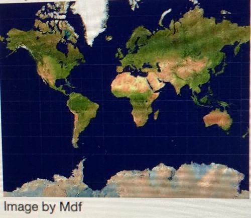
[youtube=iCHaJR831t4]
Geography
Step-by-step answer
P Answered by PhD

Answer:

The article states that the Incas developed knowledge of farming in the Andes region over the course of 11,000 years. This information shows that they refined their farming practices over time. The use of gravel, terraces, and canals allowed the Incas to adapt farming to the difficult terrain.

Geography
Step-by-step answer
P Answered by PhD

Answer:

More refugees fled Southeast Asia when Vietnam invaded Cambodia in 1979 to overthrow the murderous regime of Pol Pot. Thousands of refugees from that unhappy land began to escape over the border into neighboring Thailand.

Also the majority of Vietnamese came to Victoria after the Communist government took over their homeland at the end of the Vietnam War. Those already in Australia were offered permanent residence, and refugees began to be admitted through resettlement camps based in South East Asia.
 

Geography
Step-by-step answer
P Answered by PhD

Answer:

When birds are hungry, they will peck unripened fruit. Also, if there is no other fruit around, the birds might go after unripened fruit. Heavy bird pecking can be used as an indicator that it's ready to start harvesting.

Birds need food to eat, and plants need to disperse their seeds. Fruit-eating animals are called frugivores, and birds are the most important frugivores of all. More than 300 trees, shrubs, and vines in North America have small fruits that depend on birds for seed dispersal.

Try asking the Studen AI a question.

It will provide an instant answer!

FREE